The advancement and accomplishment of precision agriculture or satellite farming have been made achievable by combining the Global Positioning System (GPS) and geographic information systems (GIS). These telecommunications collect real-time data with precise capacity information that is pre-eminent to the effective manipulation and investigation of large amounts of geospatial data.
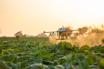
GPS depends on precision farming applications for farm planning, yield mapping, soil sampling, tractor guidance, crop scouting, variable rate applications, and field mapping. GPS allows farmers to work during low-visibility field conditions such as rain, fog, dust, and darkness. Precise technology employed in pesticides, herbicides, and fertilizers has been helpful in the dispersion of chemicals in the field of precision agriculture and it further reduces expenditure, producing a higher yield, profitable in usage, and constitute a more contexture-friendly farm.
Remote sensing mechanisms are used to explore agricultural applications such as crop discrimination, crop acreage estimation, crop condition assessment, soil moisture estimation, yield evolution, monitoring weeds and crop diseases, precision agriculture, soil analysis, and water resources mapping. Through DGPS, farmers can endure the data documentation for crop productivity which leads to a more effective profitable farming system.